FORT LAUDERDALE, Fla. — It’s beginning to look at lot like hurricane season — at least across much of South Florida, where it’s been windy and rainy for two days and the forecast predicts more of the same this busy holiday season weekend.
With today expected to be stormy over most of the state, outdoor holiday parties have been canceled and outside decorations that aren’t battened down might just blow away.
And that’s not all. The mass of wind and rain is expected to head up the East Coast of the United States just in time for the start of the holiday travel season.
“Saturday looks like a complete washout as this disturbance moves over,” said George Rizzuto, a meteorologist at the National Weather Service in Miami. “The northern part of Florida will be at risk for some pretty heavy rainfall tomorrow basically through the entire day on Saturday.”
Holiday events across the state were canceled, such as the Christmas boat parade in Indian Rocks Beach along the Gulf Coast. “See you next year,” the town website said. At least five boat parades were canceled or postponed in South Florida, including the Seminole Hard Rock Winterfest Boat Parade in Fort Lauderdale.
“The safety and well-being of our participants and spectators are of utmost importance to us,” Winterfest organizers said on their website. “The inclement weather conditions, beyond our control, make it impossible to ensure a safe and enjoyable experience for everyone involved.”
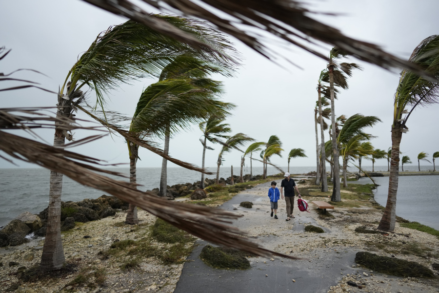
Rizzuto said winds of 20 to 30 mph are expected across much of the coastline, with gusts up to 45 mph.
Gale warnings have been issued along the coast, and Rizzuto advises boaters to take extra precaution.
“Out there over the water, you can expect some pretty rough seas, with some wave heights around 12 to 15 feet,” he said.
Gov. Ron DeSantis on Friday activated the new Florida State Guard, a civilian volunteer organization created last year, to assist with any storm impacts from such things as flooding and high winds.
“The Florida State Guard plays an essential role in Florida’s preparation for and swift response to severe weather,” the Republican governor said in a news release.
By tonight, the storm was expected to move into Southeast Georgia and then move up the Atlantic coast, arriving near the Carolinas by Monday, said Paige Klinger, a meteorologist with the National Weather Service in Jacksonville.
“That can change based on how quickly it moves,” Klinger said.
Red flags warning beachgoers to exercise caution because of the high surf and strong current were flying Friday morning along many beaches on Florida’s Atlantic coast.
In fact, beachgoers in Volusia County, home to Daytona Beach, were being encouraged not to get into the water at all. If they did, they should enter the water near a lifeguard tower and not get beyond waist deep, Volusia County officials said in a warning.
As an extra precaution, county workers removed trash cans and portable restrooms from the beach.
In Hollywood, which is between Fort Lauderdale and Miami, city officials warned residents to be mindful of floods. The area has had significant rainfall over the past two months, and some low-lying neighborhoods tend to flood in heavy rain, which is expected today.
Farther up the coast in Volusia County, Emergency Management Director Jim Judge urged residents to secure Christmas decorations for the storm.