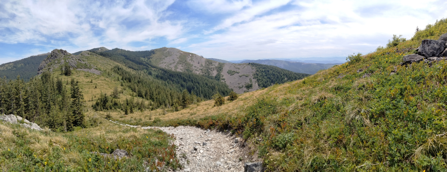
A side trail along the Grouse Vista Trail leads up a slope where you can take in this view of Pyramid Rock, the peak of Silver Star Mountain and far-distant ridges to the southeast. (Photos by Scott Hewitt/The Columbian)Photo Gallery
An exceptionally dry summer, a “devil wind” blowing from east to west and, unfortunately, boys messing around with fire led to the kind of regional catastrophe in 1902 that worries us even more today: wave after wave of intensely destructive wildfire.
Incredibly, those boys sparked the first of those fires near Eagle Creek, Ore., which became the scene of another massive conflagration sparked by another kid in 2017. Other fires also sprang up nearby, and embers eventually crossed the Columbia River and set forests ablaze in Skamania, Clark and Cowlitz counties.
Well over 230,000 acres were burned, and 64 people died as a result of the Yacolt Burn, which also resulted in the kind of strict wildfire-suppression practices that reigned for a century. Those practices are now in question because of overgrown forests that are overstuffed with fuel.
But harsh winters, rocky soils, human activity and additional wildfires stopped the forest from regenerating quickly and thickly. Instead, diverse plant life gained a foothold in the open meadows and rocky slopes of Silver Star.
With few creature-comfort amenities (like paved roads) in the vicinity, Silver Star Mountain attracts a fraction of the tourists and explorers that the Columbia River Gorge does. But visitation and recreation — and unwelcome impacts to environmental and tribal resources — are definitely on the upswing there, according to those who collaborated on a new strategic plan for gently developing while also protecting the area.
Released to the public in June, the new Silver Star Vision Plan is the result of intensive discussions among numerous interest groups and government agencies, including the Gifford Pinchot National Forest, the Washington Department of Natural Resources, the Cowlitz Indian Tribe, grassroots Washington Trails Association, the Back Country Horsemen of Washington and the Evergreen Mountain Bike Alliance.
“It’s a huge recreation zone run by two different agencies with a line right down the middle,” said Ryan Ojerio, Southwest Washington program manager for the Washington Trails Association and a chief steward of the Silver Star Vision Plan process. “They have different directives and the way they manage the land has very different personalities.”
Those two agencies are the Washington Department of Natural Resources (which manages the Yacolt Burn State Forest, most of which is in Clark County) and the U.S. Forest Service (which manages the adjacent Gifford Pinchot National Forest, to the east). Silver Star Mountain itself is just over the line in the Gifford Pinchot in Skamania County, but the Grouse Vista Trailhead and most other nearby trails and campgrounds are in the Yacolt Burn State Forest.
“DNR land has what people think of as clear cuts. They are mandated to harvest timber in the area to pay for schools. In the Forest Service areas, that stops,” Ojerio said.
Paradoxically, state DNR lands — where logging impacts are so visible — are also the ones more intensively managed for recreation, Ojerio said.
“The Yacolt Burn forest staff, they’re based in Battle Ground and what they think about every day is trails, campgrounds, campground hosts, maintenance,” Ojerio said. “The Forest Service also has a plan, but their plan says clean water and forest protection.”
There are roadless areas on the Forest Service side that will always stay that way, Ojerio said. Meanwhile, all agency stakeholders and planners are discussing possibilities for the Silver Star area, based on the new vision plan. The plan approaches the Silver Star area in sections.
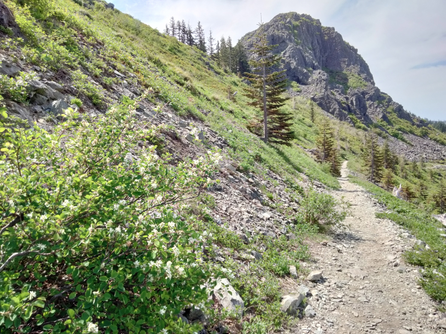
On a June day when it was 90-plus degrees in Vancouver, snow still coated some upper reaches of the steep Grouse…
The southwest zone is closest to Vancouver and where the Grouse Vista Trail begins. It’s often busy on wildflower weekends. The plan suggests enlarging the trailhead, adding a new connector to the Silver Star Trail to the east and formalizing saddle loop that starts at Pyramid Rock. It also suggests more trail sharing between hikers, rock climbers and horse and bike riders.
The plan also proposes removing trail access to tribal rock mounds and spiritual sites, and blocking access to spots where people and motorized vehicles tend to go off-trail.
The northwest zone (easily approachable via Lucia Falls and Sunset Falls Roads) has exceptional trails but also exceptionally difficult driving. A top recommendation is to fix impassible Forest Service Road 4109, allowing access to the Silver Star Trail, and even perhaps building another, better trailhead that provides access to people of different abilities. The plan also recommends decommissioning old road beds that still attract joy riders.
The east zone is the most rugged and remote. Proposals include trail improvements and new trails, as well as blocking common breach points where people drive motorized vehicles into what’s supposed to be a strictly nonmotorized area.
Work schedule
The Silver Star Vision Plan is a long-term framework for future improvements and maintenance at Silver Star, but plenty of maintenance work is going on there now, according to Ryan Ojerio of the Washington Trails Association.
Here are highlights:
June 8-10: WTA and Chinook Trail Association work party on Ed’s Trail.
June 15-16: WTA work parties at on the Grouse Vista and Tarbell Trails.
June 17: WTA work party on Pyramid Rock Trail.
June 24: On Washington Trails Day, WTA Trailhead Ambassadors greeted visitors at the Grouse Vista Trailhead.
July 15: Friends of Road 4109 road maintenance volunteer work party.
Later this summer: Chinook Trail Association to repair off-road barriers that prevent incursions into sensitive meadows and cultural resources near the Silver Star trailhead; WTA and Mount St. Helens Institute volunteers to survey trail for maintenance and sign replacement.
“I’m all for new trails but you’ve got to remember that you are digging in sacred ground. We have to have the utmost care and respect. It’s not Disney World. We have to go very slowly and consider what we’re doing,” Ojerio said.
Going slowly sounds like the plan now, he added.
“The first thing we need to do, before we encourage more people to visit, is to get our house in order — fix up the trails, repair signs and also be better equipped to teach people about the area’s special and sensitive resources.
“The vision plan will come to fruition over the next 50 years,” Ojerio said. “It will be expensive and we will proceed with caution. (Silver Star) would be overrun if we just said, ‘Come on!’ ”
Morning Briefing Newsletter
Get a rundown of the latest local and regional news every Mon-Fri morning.