SPOKANE — Fire crews worked the last two days to contain several wind-driven wildfires that burned thousands of acres and threatened dozens of structures across Eastern Washington.
As of Wednesday, three fires were burning in Benton County.
The 6,000-acre Hansen Road Fire, near Finley, was 25% contained and threatening 150 structures; the 1,000-acre Hover Road Fire, also near Finley, was 50% contained and threatening 15 structures; and the 150-acre Ruppert Road Fire, near West Richland, was 25% contained and threatening 150 structures, according to Gregory Baruso, deputy state fire marshal public information officer at the Washington State Fire Marshal’s Office.
The National Weather Service had warned of fire risk from strong winds that moved through the area Tuesday.
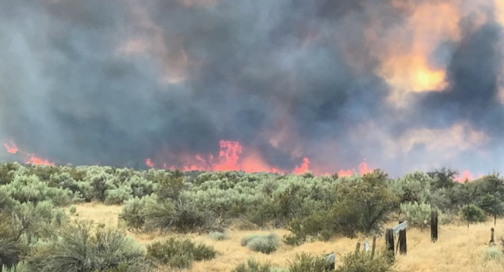
In Walla Walla County, the Hat Rock Fire near Touchet was 50% contained and threatening 125 structures, Baruso said. The blaze started late Tuesday morning northeast of Hermiston, Ore., and crossed into Washington around 8 p.m. Tuesday, according to the Washington State Fire Marshal’s Office.
The fire was burning 1,500 acres on the Washington side and 12,000 to 15,000 acres on the Oregon side Wednesday morning.
Baruso said no damaged structures or injuries related to the four fires had been reported. Evacuation notices were issued Tuesday for all the fires but have since been lifted.
State fire crews helped battle all four fires. The causes of the blazes are under investigation, according to the state Fire Marshal’s Office.
Fires were causing other impacts as well.
Smoke from a 400-acre fire in Grant County closed state Route 17 Wednesday before it opened back up Wednesday night, according to the Grant County Sheriff’s Office. The wind drove the fire — which was 6 miles south of Ephrata — east, burning grass and sage.
No homes were at “immediate risk,” and a Level 1 evacuation notice, meaning residents should be prepared to evacuate, was issued Wednesday afternoon for the area west of Rocky Ford Creek, the sheriff’s office said.
The fire was under control around 6:40 p.m. Aircraft and ground resources planned to be on scene through Thursday mopping up hot spots, the Facebook post stated.
Also in Grant County, a roughly 1,000-acre wildfire burned north of Soap Lake Tuesday but was contained Tuesday night. A Level 1 evacuation notice was issued but then canceled shortly after. No homes were lost, according to the sheriff’s office.
In Okanogan County, two wildfires were mostly contained and evacuations had been lifted Wednesday.
The 280-acre Spring Coulee Road Fire was 90% contained, and the Level 1 advisory, which had been downgraded from Level 2, was lifted Wednesday afternoon, according to the Okanogan County Emergency Management website.
The Loup Loup Canyon Fire was contained, and the Level 1 advisory was lifted, the county said.
The Spring Coulee Road Fire initially threatened two structures, but they were no longer under threat Wednesday, said Guy Gifford, public information officer at the Washington Department of Natural Resources.
Gifford said the Loup Loup Canyon Fire was 28 acres. The cause of the two fires is under investigation.