BEND, Ore. — Finding accessible hiking trails in Central Oregon can be a challenge this time of year.
Ice and snow cover many popular paths, and oftentimes snowshoeing or cross-country skiing are the best options for spending time outside.
But some trails dry up sooner than others. One such area that typically becomes accessible for hiking in the late winter or early spring is the Whychus Canyon Preserve northeast of Sisters.
The Deschutes Land Trust, a local nonprofit, protected the area not only as a haven for fish and wildlife, but also for us to enjoy. The preserve offers solitude and remoteness that feels like a true escape.
Is it the most beautiful hike in Central Oregon, with jaw-dropping mountain views and cascading waterfalls? No. But the area includes nearly 1,000 acres of intriguing canyon and stream terrain where the ponderosa pine forest meets the high desert.
In 2010, the Deschutes Land Trust established the preserve to protect 8 miles of Whychus Creek and more than 2,200 acres of adjacent flood plains, wetlands and forests.
The preserve, a 30-minute drive northwest from Bend, includes several miles of pedestrian-only trails that parallel the creek and the canyon rim, making it an ideal place for hiking, trail-running and birdwatching.
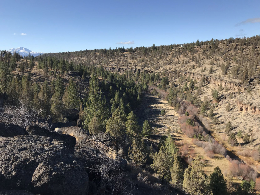
Options include a rim trail and a creek trail that can be combined for about a 5-mile loop that is fairly moderate, with about 500 feet of elevation gain. A trail also cuts through meadows above the rim and follows Santiam Wagon Road.
The creek trail follows the stream in the bottom of the canyon under the towering rimrock.
The 41-mile Whychus Creek flows out of glaciers on Middle Sister, then carves through steep, boulder-lined canyons before making its way through the town of Sisters. Past Sisters, the creek continues northeast through pine forests and high desert rimrock, eventually converging with the Deschutes River just south of Lake Billy Chinook.
Salmon and steelhead once called Whychus Creek home, and a main objective of the Oregon Department of Fish and Wildlife’s ongoing reintroduction effort is to bring those fish back to Whychus and other streams in the Upper Deschutes watershed.
Hikers can link the creek trail to the rim trail on the north end of the trail system and climb a steep path out of the canyon. Then they can make their way back toward the trailhead along the rim of the canyon, taking in views of the creek far below and of the Three Sisters peaks on the distant horizon.
A viewpoint along the rim trail offers a chance for some boulder scrambling and a sprawling view of Whychus Creek cutting through the canyon, with the snow-covered Three Sisters and Mount Jefferson rising in the distance above the rimrock.
At the south end of the trail system near the trailhead and information kiosk, hikers can take in more views of the canyon and the Cascade peaks.
According to deschutesland-trust.org, Whychus Canyon Preserve is home to many native wildflowers. Its sagebrush plateaus are the first to warm up each spring and include some of the earliest blooms in Central Oregon.
The 5-mile hike/trail run requires about two hours and is moderately difficult along the short, steep sections that connect the creek trail and rim trail.