<img height="1" width="1" style="display:none" src="https://www.facebook.com/tr?id=192888919167017&amp;ev=PageView&amp;noscript=1">
Saturday,  April 27 , 2024

Linkedin Pinterest
News / Nation & World

Snow piles up in North Dakota as region’s first major snowstorm of the season moves eastward

By JACK DURA, Associated Press
Published: October 26, 2023, 11:14am
2 Photos
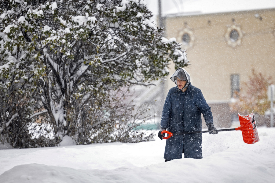
A woman shovel snow, Wednesday, Oct. 25, 2023, in Helena, Mont. The first major snowstorm of the season dropped up to a foot of snow in the Helena area by Wednesday morning, canceling some school bus routes.
A woman shovel snow, Wednesday, Oct. 25, 2023, in Helena, Mont. The first major snowstorm of the season dropped up to a foot of snow in the Helena area by Wednesday morning, canceling some school bus routes. (Thom Bridge/Independent Record via AP) Photo Gallery

BISMARCK, N.D. (AP) — Nearly a foot of snow buried parts of North Dakota on Thursday as the region’s first wintry weather of the season swept through the Rockies and into the northern Plains, slowing travel and frustrating some farmers who still have crops left to harvest.

The storm dumped as much as 11 inches (28 centimeters) of snow near Stanley, North Dakota, in the state’s northwest corner, and other areas saw up to 8 inches (20 centimeters), said Matt Johnson, a meteorologist with the National Weather Service in Bismarck.

“Well, it is definitely winter,” said Karolin Jappe, the emergency manager for McKenzie County.

Jappe ventured out twice Wednesday to the scene of a semi rollover with hazardous materials and said driving was a challenge. Some motorists had rolled their vehicles or slid into ditches, which Jappe said “is normal” given the conditions.

“You could barely see anything but white. It just kinda scares you,” she said.

The storm, an upper-level low from western Canada, came across the northern Rockies and is expected to continue east into Canada as cold Arctic air remains behind into next week, Johnson said. The storm’s second wave was expected to impact central and southwestern North Dakota, with the heaviest snow expected to come later Thursday afternoon, he said.

Below-normal cold temperatures are forecast to follow, as low as single digits and possibly even below zero in low-lying areas, Johnson said. The snowpack will enhance the cold temperatures, he said.

In south-central North Dakota, Mandan-area farmer and rancher Stephanie Hatzenbuhler’s family has been preparing for the storm for days, rounding up their cattle to keep closer to home, fixing fence, bringing in farm equipment and eyeing their snow removal equipment.

The family still has corn to harvest, “but hopefully it doesn’t snow too much and it gets nicer out again to where we can get back at that job,” Hatzenbuhler said.

Farmer and rancher Kenny Graner drove to Mandan on Thursday for truck parts and noticed the road conditions go from a trace of snow and mist to more snow accumulating on his route.

“It’s unreal, the difference in 15 miles,” he said.

Earlier this week, his family began shifting cattle around into pastures with natural protection and springs for water, he said. The family was about 90% done with their corn harvest before the storm.

“It slows you down,” Graner said. “There’s a lot of fall work farmers and ranchers want to get done before the ground freezes up. This technically slows you down for a week or so until the ground would be dry enough if there’s any kind of fall tillage they want to do. That’s probably not going to get done or only a little bit.”

About half of the state was under a travel alert Thursday, meaning drivers may still travel in the area but should be aware of the wintry conditions that could make traveling difficult.

The state issued a no-travel advisory Wednesday afternoon for highways in several North Dakota counties but those warnings have been lifted. A roughly 30-mile (48-kilometer) stretch of U.S. Highway 85, a major route through North Dakota’s oil field in the western part of the state, was closed for more than 12 hours Wednesday evening to Thursday morning.

Loading...