Nestled in the center of Lacamas Park, Woodburn Falls is a hidden gem.
• Lacamas Creek — The lower trailhead is just off Northeast Third Avenue in Camas opposite the intersection with East First Avenue. Turn in to what looks like a private driveway to a small parking lot on the west side of Lacamas Creek. The trail starts about 30 yards to the north at a signed gate.
• East Fork Lewis River — Take state Highway 503 north of Battle Ground and turn right on Northeast Rock Creek Road, which morphs into Northeast Lucia Falls Road. Follow Lucia Falls Road for 5.4 miles to the junction with Hantwick Road. Turn right at proceed .6 mile to the parking lot at the trailhead.
• Salmon Creek — The west trailhead includes on-street parallel parking at Northwest 36th Avenue near Felida Bridge.
It’s like a scaled-down version of Fairy Falls on Wahkeena Creek in the Columbia River Gorge National Scenic Area, and best visited in the rainy days of winter.
• Lacamas Creek -- The lower trailhead is just off Northeast Third Avenue in Camas opposite the intersection with East First Avenue. Turn in to what looks like a private driveway to a small parking lot on the west side of Lacamas Creek. The trail starts about 30 yards to the north at a signed gate.
• East Fork Lewis River -- Take state Highway 503 north of Battle Ground and turn right on Northeast Rock Creek Road, which morphs into Northeast Lucia Falls Road. Follow Lucia Falls Road for 5.4 miles to the junction with Hantwick Road. Turn right at proceed .6 mile to the parking lot at the trailhead.
• Salmon Creek -- The west trailhead includes on-street parallel parking at Northwest 36th Avenue near Felida Bridge.
Despite its suburban sprawl, Clark County still has a handful of hiking spots with a bit of backcountry flavor, the six-mile network of trails and closed access roads in Lacamas Park being a prime example.
For a good map of Lacamas Park’s trails, visit http://www.cityofvancouver.us/parks-recreation/parks_trails/trails/lacamas_trail.htm. The route along Lacamas Creek is the most interesting.
Starting in Camas, this path follows Lacamas Creek for 0.8 of a mile upstream to the dam on Round Lake.
Slightly beyond the half-mile point, the trail crosses Lacamas Creek at Lower Falls.
Immediately upon crossing the bridge, the trail forks. Take the hard left and climb to a crossing of Woodburn Creek.
The trail ends at the junction with the Round Lake Loop trail. Veer to the left and visit the dam that creates Round and Lacamas lakes.
The flow in Lacamas Creek is greatest during the winter and that makes the falls and cascades more scenic.
This trip connects to Round Lake Loop, encircling Round Lake and adding 1.2 miles.
Here are two other hikes in Clark County:
East Fork Lewis River trail — A 2.4-mile trail extends from a trailhead on Hantwick Road east to Moulton Falls County Park.
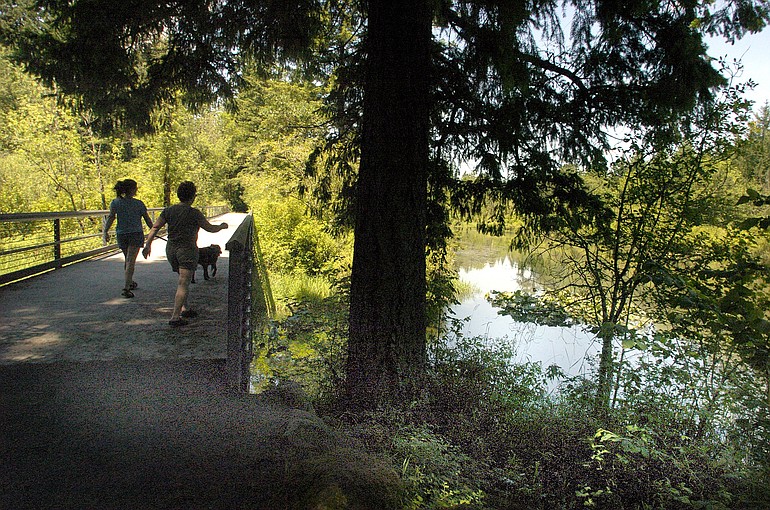
The western half-mile or so of the trail is paved and leads to a large pond, including a bench for taking a break.
The remainder of the trail is gravel to the bridge that crosses the East Fork of the Lewis at Moulton Falls park.
The eastern end of the trail parallels Clark County’s premier stream and several tributaries cascade down from the steep hillside to the south.
Bells Mountain trail, which leads 7.5 miles to Cold Creek campground, junctions with the Hantwick-Moulton Falls trail about a half-mile west of Moulton Falls park.
Salmon Creek trail — Salmon Creek Greenway is a three-mile paved path along lower Salmon Creek between Salmon Creek Park and Northwest 36th Avenue.
Mallards, mergansers and other ducks can be seen in the wetlands. At one point, there’s a view of Mount Hood on clear days.
Trailheads are available at Salmon Creek Park on the east or on Northwest 36th Avenue at Felida Bridge on the west.