WILLARD — The raven perched on the corner of a picnic table in Forlorn Lakes campground appeared to be waiting — patiently — for a food tidbit.
The bird won’t have to wait much longer.
The campground in the Mount Adams District of the Gifford Pinchot National Forest is free of snow and its access road will finish melting out any day now.
It’ll be a short summer this year in the high country as the effects of a late winter and cool spring linger, with snow blocking some roads at elevations as low at 3,500 feet.
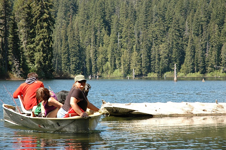
On Sunday, Clark County resident Bill Kelley was trying his luck for trout at nearby Goose Lake.
“I think this is the first weekend it’s been accessible,” Kelley said. “I haven’t had much of a salmon season so I thought I’d come here and fish.”
Goose Lake is accessible via roads Nos. 60 and 66 from the south and east sides, but road No. 60 coming east from Carson across the crest of the Cascades south of Red Mountain remains blocked with snow.
While Goose Lake campground is ready for visitors, many spots in the Gifford Pinchot are not.
The popular campgrounds on the west flank of Mount Adams are inaccessible due to snow on forest roads No. 23 and 2329.
Road No. 23 is open to Lewis River No. 90.
Among the campgrounds open are Beaver, Panther Creek, Paradise Creek, Goose Lake, Peterson Prairie, Lower Falls, Sunset Falls, Tower Rock, North Fork, La Wis Wis, Iron Creek, Big Creek, Adams Fork plus Cody and Kalama horse camps.
La Wis Wis and Peterson Prairie don’t have potable water.
Road access becomes an issue at elevations above about 3,600 feet. While some south-facing stretches are free of snow, shady locations still have 18 inches or more.
Road No. 24 is open to junction with road No. 8821. Road No. 30 in the Wind River area is open to Lone Butte.
Road No. 25 connecting the Cowlitz Valley and upper North Fork of the Lewis River is open heading south to Wakepish Sno-Park and heading north to road No. 93.
Road No.99 to Windy Ridge viewpoint is closed by snow.
Road No. 81 is closed by snow at Red Rock Pass. Road No. 83 is open to Lahar. Talks by forest rangers at Lahar begin on Saturday.
Road No. 4109 to the trailhead on the north side of Silver Star remains closed.
Roads Nos. 54, 57 and 5701 are open from Chelatchie to the Siouxon Creek trail No. 130 parking area.
Roads Nos. 80 and 8040 are open three miles past Wicky Creek Shelter.
Lewis River road No. 90 is open to road No. 23.
Hikers will find spotty conditions with the snow level 3,500 to 4,500 feet elevation on most trails. Snow patches are less of a problem the farther east in the forest.
The Pacific Crest National Scenic Trail is open to 4,500 feet elevation from Williams Mine trailhead. Snipes Mountain No. 11 is open to the junction with Pineway trail. Morrison Creek trail No. 39 has been logged out.
Sleeping Beauty trail No. 37 has snow patches, but is open to the summit. Langfield Falls No. 8 and Little Huckleberry No. 49 are open.
Trapper Creek No. 192 is logged out to Trapper Bridge. Observation No. 132 is logged out to Sunshine junction. The trail is very hard to follow once under snow. Dry Creek No. 194 is open.
Lewis River No. 31 is open, although muddy in spots. Quartz Creek No. 5 is open to Straight Creek, where the crossing is difficult. The lower ends of Wright Meadows No. 80 and Cussed Hollow No. 19 are open.
Packwood Lake No. 78 is open to the lake and for about another 1.5 miles toward Mosquito Lake before the snow gets deep.