CELILO, Ore. — It’s pleasant in the lower Deschutes River canyon, as in 60 degrees. Six weeks from now, it might be hot, as in 90 degrees.
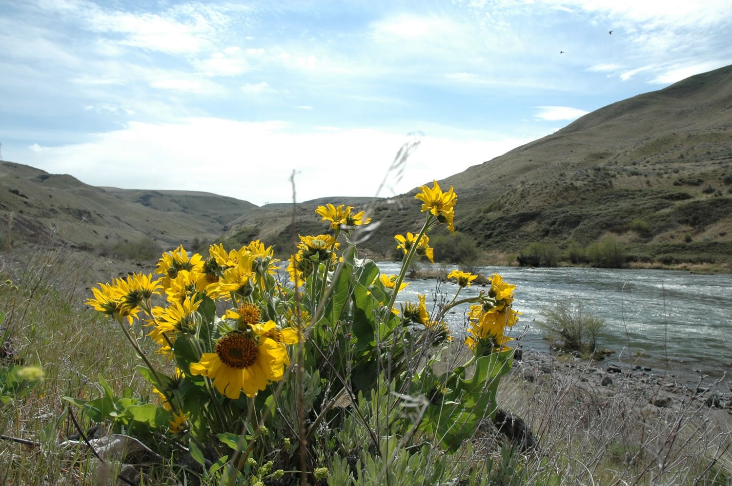
Today, the balsamroot and desert parsley are blooming, adding splashes of yellow to a canyon carpeted green with new shoots of grass.
Six weeks from now, after the heat builds, everything will be a golden shade of brown.
“Look at it,” said Jim Larson of Rockway Beach, Ore., while standing near a small patch of balsamroot and its showy dislay. “It’s just a great time to be here.”
Getting there: Take Interstate 84 east to milepost 97 and take the exit to Oregon 206. Turn left and follow Oregon 206 for three miles. Cross the Deschutes River bridge and turn right into the park.
Camping sites: 34 with electricity, 25 primitive, 4 group RV/tent areas.
Fees: Beginning May 1, the rates are $20 for a site with water and electricity, $9 for a primitive site and $71 for a group area.
Information: 541-739-2322 or 1-800-551-6949
Reservations: 1-800-542-5687
Online: http://www.oregonstateparks.org/park_37.php
The take-home message: April and May are the best months of the year to visit the eastern half of the Columbia River Gorge.
Enough of this overcast, cool and rainy weather. Drive 100 miles and escape for a day.
Although spring is behind schedule in Clark County, the season is in full swing in the lower Deschutes River canyon, where the wildflowers start blooming in late February.
“April and May can be great weather with days in the 70s out here,” said Dave Splanger, ranger assistant at Oregon’s Deschutes River State Recreation Area.
A former railroad grade on the east side of the Deschutes River has been converted into a bike trail, although hikers and some horsemen use it too.
“This is like the only trail that’s snowfree and dry,” Splanger said last week.
Mountain bike riders can begin at the park entrance and follow the river for 17 miles on the old railroad grade. The path is wide and mostly dirt, except for compact gravel in places.
Larson and his wife, Linda, camped Friday through Tuesday at the park.
“I used to run here,” he said of the railroad grade-bike path. “It’s a great surface to run on.”
The park offers a semi-loop hike of 4 to 7 miles by combining a trail along the edge of the Deschutes, the bike route and Ferry Springs trail, a 1.7-mile side trail that climbs about 500 feet in elevation to spring.
To make the hike, enter the park and drive to the southernmost parking area. Day-use parking is free. Walk .16 mile through a grassy area to the trailhead sign and follow the arrow for “River Trail.”
The River Trail, a mid-slope trail, and the bike trail all parallel each other heading up the Deschutes River. Follow the River Trail for 2 to 3 miles, then take one of the several connecting paths up the slope to the bike route.
Head back downstream on the bike route. A no-biking sign on a trail heading east and up the hill marks the south junction with the Ferry Springs trail.
Ferry Springs trail climbs almost 500 feet elevation in .66 mile to the springs, then follows an old stagecoach route down to the bike path. Once at the bike path, it’s a little less than a half mile back to the parking lot.
Larson said he has ridden the entire bike route, once getting a flat tire 15 miles away from the park.
Splanger said camping use of the state park ramps up beginning Memorial Day weekend, with the unofficial start of summer.
“The heaviest usage is mid-July, August, September even into the first couple weeks of October during the summer steelhead season,” he said.
The majority of the trail use is fishermen, followed by mountain bike riders, he added.
Heritage Landing on the west side of the Deschutes River mouth is a popular launch for jetboats. The boats are allowed on the lower Deschutes most of the year.
The lower two miles of the river is a pass-through zone for boaters. This provides fishing opportunity for bank anglers.
Splanger said camping allow is not allowed in the first two miles up the trail.
Horseback riding is allowed only in March through June, with only 10 horses per day allowed on the trail. Reservations are made by calling Reservations Northwest at 1-800-452-5687.
“It’s a popular horse destination in the spring, Splanger said. “It’s a beautiful ride.”