B.G. man says project has harmed spawning grounds for fish; agency disputes his claims
By Eric Florip, Columbian
Transportation & Environment Reporter
Published: July 25, 2013, 5:00pm
Share:
2 Photos
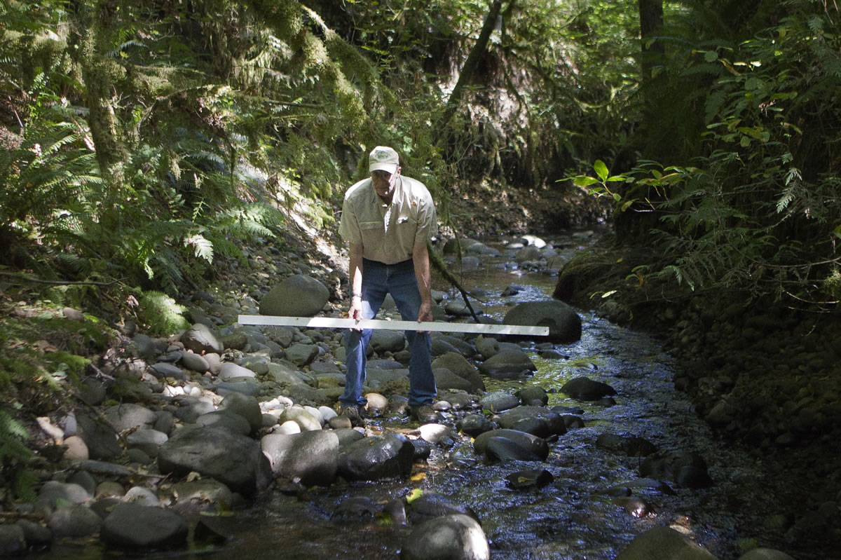
Dave Brown of Northwest Wild Fish Rescue uses a ruler to demonstrate the decreased level of Mill Creek North on his property outside Battle Ground. Brown said high flows in the last year flushed out a large amount of gravel and destroyed fish spawning grounds.Photo Gallery
BATTLE GROUND — Dave Brown has seen Mill Creek North shift before. But nothing like he saw during the last rainy season, he said.
“This was abrupt,” he said.
The creek, which meanders through Brown’s property outside Battle Ground, saw heavy flash flows last season, washing out gravel that’s crucial for fish spawning grounds, Brown said. He estimates the creek bed itself dropped as much as 1 to 2 feet in places.
Brown has directed his ire at the Washington State Department of Transportation, which oversaw the construction of a wetland just off state Highway 502 last year. Brown says the wetland “worked like a parking lot” during fall and winter rains, damaging the creek that flows north from the site before it connects to the East Fork Lewis River.
But WSDOT officials insist the site is functioning just as it was designed to. If there was damage farther down Mill Creek North, they said, it wasn’t caused by the wetland. On-site monitoring gauges showed that the wetland retained and controlled water well during the fall and winter, even adding capacity to the area, according to the department.
“I don’t see what Mr. Brown sees,” said WSDOT area engineer Chris Tams. “It’s difficult for us to see how it could be anything other than more water to sit over a longer period of time.”
WSDOT transformed much of the 65-acre wetland site as part of a planned widening of state Highway 502 between Interstate 5 and Battle Ground. The mitigation effort rehabilitated 26 acres of existing wetlands, and created another 5 acres of wetlands, according to the agency.
As part of that process, crews stripped the top layer of soil from the site to remove non-native canary grass. They rerouted the creek from a straight-line ditch to a more natural pattern. And they planted some 250,000 young trees and shrubs on the property, according to WSDOT.
Though the actual highway expansion isn’t expected to start until 2014, crews completed the wetland work last summer. In many projects, mitigation essentially creates new wetlands to make up for existing ones buried by construction elsewhere.
On the main wetland site just north of Highway 502, crews used a thorough process and GPS technology to execute a design approved by the state Department of Ecology and others, said Dan Corlett, a WSDOT mitigation manager.
“When we design a site like this, it’s based purely in science,” Corlett said. “We take this very seriously.”
WSDOT officials acknowledged that they haven’t monitored connected waterways far beyond the wetland site itself. Mill Creek North, for example, flows mostly through private property on its way to the East Fork Lewis River.
Brown, who runs a wild fish rescue operation from his home, has lived along Mill Creek North for more than 20 years. He spent a recent morning walking along the creek, describing major changes in its character. In some areas, gravel on the creek bed has washed out entirely, lowering the channel, he said. At one bend, a large gravel bar has piled up and shifted the path of the creek by several feet.
Brown said many fish eggs were likely ground up in churning rocks. And a steep drop in the number of fish on the creek this year shows an alarming trend, he added.
Dick Dyrland, a hydrologist with the nonprofit Fish First, said he could see signs of high flows and undercut banks along the creek. Though he hadn’t surveyed the waterway in detail, it appears the area has seen significant changes, he said.
Regardless of what caused it, “losing that gravel is not a good thing, no matter what,” Dyrland said.
He added: “These small tributaries are the lifeblood of the East Fork.”
Numerous factors influence the behavior of any waterway or wetland, Corlett said. In November, a strong weather system dumped several inches of rain on the Battle Ground area in a relatively short time. That came on the heels of a record-setting dry stretch that had parched the entire region. The sudden influx of water had to go somewhere quickly, Corlett said. The event caused some erosion at a separate WSDOT wetland site to the east, Corlett said.
Regular monitoring of the main wetland will continue for at least a decade, according to WSDOT. The agency hasn’t changed the grading or composition of the area since last year, and has no plans to, Corlett said.
Brown said he hopes the condition of Mill Creek improves as vegetation grows in at the wetland site. But it’s clear the waterway has suffered a short-term blow, he said.
“I know exactly what this creek looks like,” he said.