<img height="1" width="1" style="display:none" src="https://www.facebook.com/tr?id=192888919167017&amp;ev=PageView&amp;noscript=1">
Monday, March 18, 2024
March 18, 2024

Linkedin Pinterest

Chasing waterfalls around Clark County

For fun & adventure, check out these eight destinations

By , Columbian Assistant Metro Editor
Published:
10 Photos
Columbian files
Moulton Falls, shown in 2008, is on the East Fork Lewis River between Yacolt and Battle Ground.
Columbian files Moulton Falls, shown in 2008, is on the East Fork Lewis River between Yacolt and Battle Ground. Photo Gallery

Who doesn’t love a good waterfall?

Each year, gobs of tourists flock to take selfies before the famed Multnomah Falls on the Oregon side of the Columbia River Gorge. And understandably so. There, the water falls about 620 feet from the top of a cliff to a pool below, spraying a constant mist at visitors.

But Clark County has plenty of its own, lesser-known falls, many of them accessibly by hike or car. They aren’t as mighty as the Multnomah, but they’re closer to home, and each have something to offer.

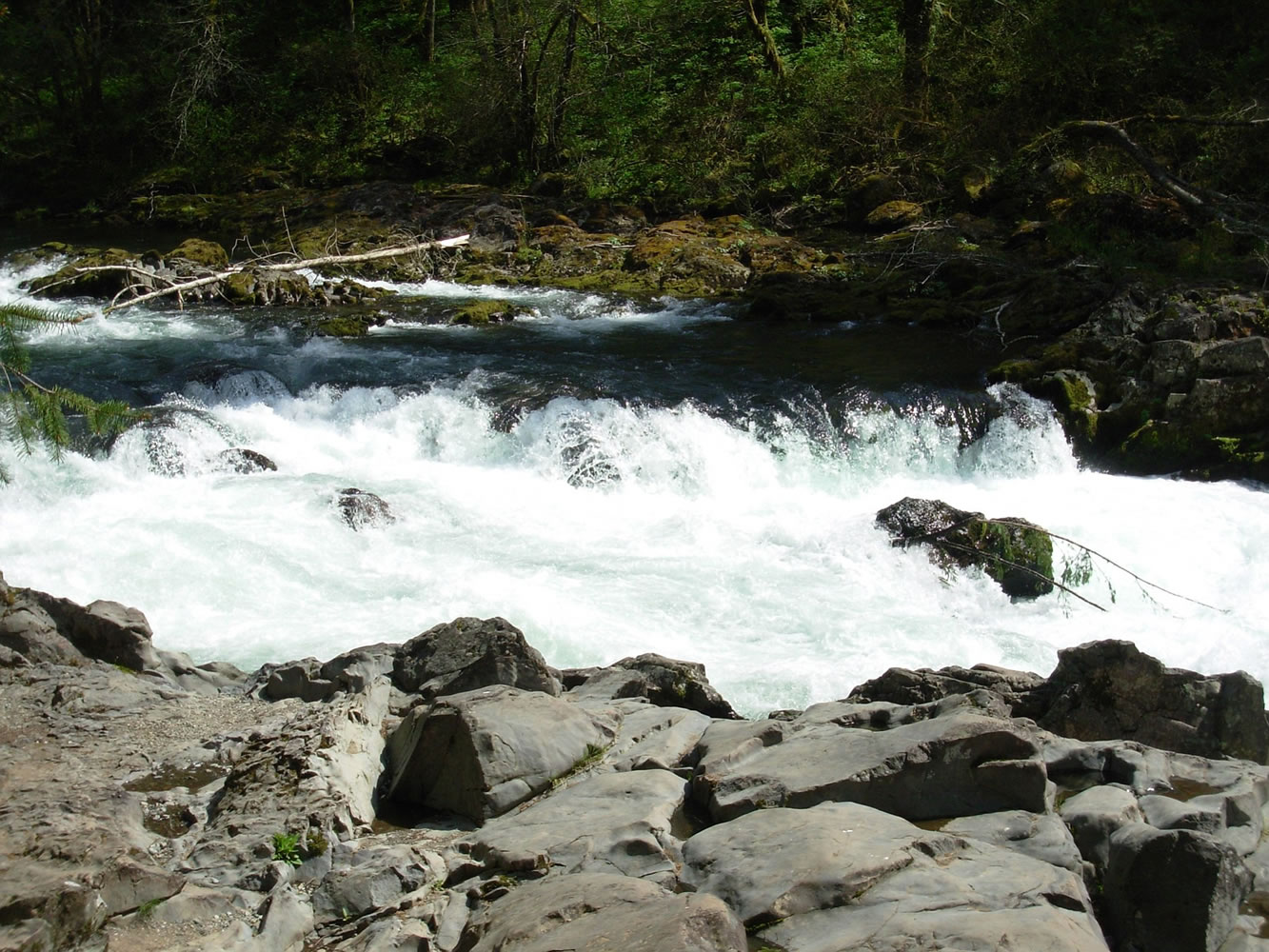
If you’re really into waterfalls, you might know there’s a network of waterfall hunters cataloging all the known falls in the Northwest. That project — the Northwest Waterfall Survey — lists 22 waterfalls in Clark County, eight of which are easily accessible.

Here’s a list of those eight falls, how to get to them, and the best time to see them. There are no fees or parking passes required to visit these waterfalls.

For more photos and a map showing the locations of the eight waterfalls listed in the story, hover your mouse over the photo at the top of the story, then click on the directional arrow to move through the photo slider. Also, a list of Northwest waterfalls is available on the Northwest Waterfall Survey website at http://www.waterfallsnorthwest.com

1) Pothole Falls: A hidden gem in Camas, Pothole Falls on Lacamas Creek is pretty, but it’s hard to spot. The view from most vantage points is obscured by trees and brush, so visiting during a time of year when there are fewer leaves on the trees is recommended. Visitors who manage a good glimpse will see wide falls streaming 20 feet down over smooth rock ledges and potholes.

Access: About a 10-minute stroll from the car.

Best time to view: Winter. Park hours are 7 a.m. to dusk.

Directions: From the parking area at Lacamas Lake Regional Park, 3344 N.E. Everett St. in Camas, walk south on the path along Round Lake and cross over the lake’s dam. Follow signs for Woodburn Falls, then for Lower Falls. You likely will hear this waterfall before you see it. One of the best spots to see the falls is found by following the creek downstream to a grassy area.


2) Lower Falls:
After catching a peek at Pothole Falls in Lacamas Park, stay a while and visit Lower Falls, also on Lacamas Creek, that can be a bit difficult to see in its entirety. The falls are about 70 feet wide and 30 feet tall. There’s a viewing area on a footbridge above the falls and a way to look back at the falls from a lower spot a couple of hundred feet downstream.

Access: A half-mile walk from Pothole Falls.

Best time to view: Winter and spring. Park hours are 7 a.m. to dusk.

Directions: Follow the trail along Lacamas Creek downstream for about a half mile. Turn right to see the falls from the footbridge or continue along a path downhill along the creek to see the waterfall from another point of view.

3) Woodburn Falls: From Lower Falls, continue exploring the trails at Lacamas Park and find the more remote Woodburn Falls on Woodburn Creek. This one’s about 20 feet tall with a lower flow. Visit it if you want a more secluded waterfall experience.

Access: About a half-mile walk from Pothole Falls.

Best time to view: Winter. Park hours are 7 a.m. to dusk.

Directions: Retrace your steps from Lower Falls to Pothole Falls and follow signs for the access road that connects to Southeast Crown Road. Follow the access road toward Crown until you see a path on the right that’s marked with a sign for Woodburn Falls. Take the Woodburn Falls trail to a fork; take the middle path to find the falls.


4) Big Tree Creek Falls:
This waterfall, nearly 60 feet tall, is on Weyerhaeuser property in northeast Clark County, just outside the town of Yacolt. It’s one of the best falls in the county, but the trails around it aren’t well maintained. A simple-to-follow path leads to an overlook; from there, it’s a 10-minute trek to get to the base of the falls, but that journey is recommended for skilled hikers only. The path to the bottom of the waterfall is overgrown, steep in spots and requires scrambling down between two boulders.

Access: A three-minute walk from the car.

Best time to view: Winter and spring.

Directions: From Yacolt, drive east on East Yacolt Road, which turns into Northeast Falls Road. About 2 miles outside of town, there will be a gated road on the right, 8600 Falls Road. Park outside the gate and walk down the road until you find a trail on the right, just before the road crosses the creek. Follow the trail to the overlook.


5) Yacolt Creek Falls:
After stopping at Big Tree Creek Falls, it’s less than a 10-minute drive to Yacolt Falls, a two-tiered, 28-foot-tall waterfall on a creek that feeds into the East Fork of the Lewis River. A path around the creek and a footbridge over it provide numerous vantage points for these falls.

Access: A two-minute walk from the car.

Best time to view: Winter and spring. Park hours are 7 a.m. to dusk.

Directions: From Yacolt, drive south on Northeast Railroad Avenue, which turns into Northeast Lucia Falls Road. If traveling from south county, drive state Highway 503 north from Battle Ground, and after about 5½ miles, turn right on Northeast Rock Creek Road, which turns into Northeast Lucia Falls Road. Follow the road for several miles until you find a parking area across the road from Sunset Falls Road. From there, walk west briefly until you reach a viewing area with picnic tables. Take the stairs down to the falls.


6) Moulton Falls:
This waterfall at Moulton Falls Regional Park shoots “down a narrow trough, dropping over a series of potholes for about 10 vertical feet,” according to the Northwest Waterfalls Survey, but when the East Fork of the Lewis River is high, it becomes more of a “rushing rapid than a waterfall.” The park has more to offer than the falls; it’s a popular destination for swimmers in warmer months, boasts an arch bridge over the river that’s more than three stories high and is home to the trailhead for the Bells Mountain Trail.

Access: A short walk from the Moulton Falls parking lot, or a five-minute walk from Yacolt Falls.

Best time to view: Winter and spring. Park hours are 7 a.m. to dusk.

Directions: Follow the directions to Yacolt Falls, but drive farther west to Moulton Falls Regional Park, 27781 N.E. Lucia Falls Road. Or stay parked at Yacolt Falls and take the walking path to Moulton Falls. That’s the path that follows the creek downstream to the left after you cross the bridge at the base of Yacolt Creek Falls and walk up the steps.


7) Lucia Falls:
This waterfall on the East Fork of the Lewis River cascades over exposed bedrock, falling 15 feet on its journey downstream. On occasion, salmon are seen jumping up these falls.

Access: A five-minute walk from the car.

Best time to view: Winter and spring. Park hours are 7 a.m. to dusk.

Directions: Follow the directions to Yacolt or Moulton falls. From Moulton Falls, drive west on Lucia Falls Road until on your left you see Lucia Falls Regional Park, 21803 N.E. Lucia Falls Road.

8) Grist Mill Falls: This waterfall just upstream of the Cedar Creek Grist Mill is so small, it could be mistaken for simple rapids. Don’t make a special trip to see this one. Rather, make it part of a visit to the historic grist mill, which is open 1 to 4 p.m. Saturdays and 2 to 4 p.m. Sundays.

Access: By car.

Best time to view: Summer and fall.

Directions: From Interstate 5, take Exit 21 for Woodland and take East CC Street east over the North Fork of the Lewis River. Turn left onto Northwest Hayes Road, which turns into Cedar Creek Road. After driving about 8 miles, turn left onto Grist Mill Road and continue about three-quarters of a mile to the mill, 43907 N.E. Grist Mill Road. The waterfall is just upstream of the mill; the best views are from the windows of the mill’s enclosed deck, or from the nearby covered bridge.

Many gorgeous falls just one county east

For those willing to drive farther, there are some breathtaking falls to the east in Skamania County. Here are five that score high marks with the Northwest Waterfall Survey. A Northwest Forest Pass might be required to visit some of these falls.

1) Lower Lewis River Falls: This waterfall on the Lewis River is a whopping 200 feet wide with a 43-foot drop.

Access: About a 500-foot walk from the parking area. The drive from Woodland takes about 1 hour and 45 minutes.

Best time to view: April through August.

Directions: From Woodland, take state Highway 503 east to Cougar and continue to Forest Service Road 90, just past the Pine Creek ranger station. Take the service road 14 miles to the Lower Lewis Falls recreation area. Parking to the right of the entrance. Several trails along the canyon lead to a view of the falls.

2) Upper Lewis River Falls: Nearby, on the Lewis River, this 175-feet-wide waterfall flows over a flat rock slab before falling 58 feet. The trail to this waterfall also passes Middle Lewis River Falls, the widest of the waterfalls on this river.

Access: A 1¼-mile hike from the Middle Falls trailhead.

Best time to view: Year-round.

Directions: From the Lower Lewis Falls recreation area, drive east on Forest Service Road 90 for 1 mile and park at the Middle Lewis River Falls parking lot. Hike a half-mile to Middle Falls, then continue for three-quarters of a mile to find the Upper Lewis River Falls.

3) Falls Creek Falls: One of the most powerful falls in Southwest Washington, this waterfall on Falls Creek drops about 130 feet.

Access: A nearly 2-mile hike from the trailhead. The drive to the trailhead from Vancouver takes about 1½ hours.

Best time to view: Year-round. The forest road is closed December through March.

Directions: From Carson, take the Wind River Highway north about 16 miles and turn right onto Forest Road 3062. Drive about 2 miles, following signs for the Lower Falls Creek trailhead. From the trailhead, hike nearly 2 miles to the base of the waterfall.

4) Dog Creek Falls: This 30-foot waterfall is just east of Dog Mountain, a popular hiking spot. Bring a bathing suit if you want to take a dip in the pool below the falls.

Access: A short walk from the car. The drive to the falls takes about 1 hour from Vancouver.

Best time to view: Winter and spring.

Directions: Drive about 6 miles east of Carson on state Highway 14 to a parking pullout near Dog Creek, which is marked with a sign. Walk the trail about 100 feet to the falls.


5) Cape Horn Falls:
This waterfall runs over several rocky ledges on its 600-feet plunge into the Columbia River.

Access: A 2- to 3-mile hike from the car. The drive to the parking turnout takes about a half-hour from Vancouver. Or see the falls from across the Gorge while walking the loop trail at Bridal Veil Falls State Park in Corbett, Ore.

Best time to view: Winter. These falls usually dry up by mid-May.

Directions: Drive state Highway 14 until you reach a parking lot at Salmon Falls Road. Walk down Cape Horn Road until it ends at the trailhead. This section of the trail is closed from Feb. 1 to July 15 for falcon protection. During the falcon closure, take the Cape Horn loop from the other direction; the trailhead is across Salmon Falls Road from the parking area.

SOURCE: Northwest Waterfall Survey

Loading...
Columbian Assistant Metro Editor