With an exceptionally dry May behind us and warmer summer temperatures on the horizon, officials say conditions seem to be lining up for a potentially busy fire season around much of the Pacific Northwest.
The number of fires in the Northwest tends to hang around 3,000 to 5,000 each season, said John Saltenberger, the fire weather program manager at the Northwest Interagency Coordination Center in Portland.
The big question is how many of those will be especially large — one reason why forecasters plan around the potential for large-scale wildfires.
The latest three-month outlook from the forecasters at the National Interagency Fire Center in Boise said the Northwest will see normal potential for significant fires through the month. In Southeast Washington and the southern and north-central parts of Oregon, those chances will rise to above-normal in July.
For August and September, the forecasters predict more above-normal potential for big fires east of the Cascade Crest in Oregon and Washington, as well as Southwest Oregon.
The significant fire potential in Southeast Oregon’s conditions should return to normal in September.
For elsewhere in the Northwest, the chances for significant fires will be about normal throughout the summer, but Saltenberger said, if weather trends continue, the odds might increase across the region.
“Much of the geographic area, by which I mean Oregon and Washington, are anticipating an above-average potential for July and August,” Saltenberger said.
That might even include the typically wetter west side of the Cascades.
Saltenberger said recent cool and rainy weather moderated fire conditions, leaving things about average for mid-June. Relatively moderate fire danger ought to linger, region-wide, through the month, but parts of the Northwest might see lightning over the weekend.
The Boise forecasters noted most areas across California, Oregon and Washington received about half of their average rainfall in May.
Forecasters said, much of the West’s higher elevation winter snowpack was well below average, save parts of Washington where it was about normal, but the abnormally dry spring might offset that.
That might mean extra dry mountain vegetation come the heat of July, forecasters said.
The U.S. Drought Monitor says a moderate drought has persisted across Eastern Oregon, and weather outlooks show those conditions will likely continue through August.
Forecasters and planners were concerned the drought areas will persist and grow through summer, the Boise agency said.
Saltenberger, noting drought and vegetation tracking isn’t his area of expertise, said in more than 30 years of working, it hasn’t been the best indicator of large fire potential in the Northwest.
Last year is a good example, he said: Winter was very cold and wet, but by July, there were serious fires burning across Oregon and Washington.
The combination for large fires in the Northwest has often involved a lightning storm rolling through an area where it has been especially hot and dry, he said.
“It’s better said the weather in the later spring and summer is much more telling example of what the fire season will be like,” Saltenberger said. “What it mainly amounts to, is where lightning shows up in those hot, dry periods. Where and when.”
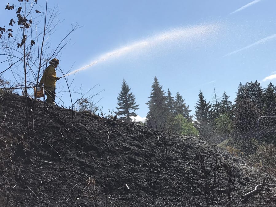
Clark County Fire District 3 Chief Scott Sorenson said, locally, firefighters have already been busy with outdoor fires.
“We’ve had grass and bark dust fires that typically happen after July 4,” he said. “We’re on the west side, so, typically, that doesn’t happen until we start to get more of a dry-out pattern.”
While there’s a consensus conditions might be volatile, Tim Dawdy, a division chief at Clark County Fire & Rescue, cautioned making plans and predictions for fire season is often a loser’s game.
“This is my 35th year doing this, and I don’t think anyone has a really great crystal ball,” he said: When the spring is wet and the plant growth is decadent, the prognosticators predict big fire; when there’s a drought, they do the same thing.
Up until it rained over the weekend, he said, there were parts of the west side of the Cascades that were likely drier than in the west,
That said, the historical recipe for fires in Southwest Washington has been mid- and late-summer hot spells coupled with an east wind through the Columbia River Gorge. That combo was there for the enormous Yacolt Burn and Tillamook Burn fires of the early 20th century, an October 1991 fire that almost burned down the lodge at Multnomah Falls, and, more recently, the Eagle Creek Fire.
When those conditions are present, it’s imperative to be careful with fire.
“That’s where we want people to really take it easy and go out and check their burn piles, see if the burn piles have come back to life, not light any new ones, check their barbecues,” he said. “These types of things.”