WINDY RIDGE — Looking into the crater of Mount St. Helens, it can be difficult to grasp the scale of the massive geologic amphitheater.
That’s true even from the closest vantage points. Peter Frenzen, the Mount St. Helens monument scientist, helps put things in perspective.
Frenzen points out that the older lava dome inside the crater dwarfs Seattle’s Space needle. The volcano’s newer lava dome, formed between 2004 and 2008, reaches higher than the Empire State Building. And the entire mile-wide crater is large enough to encircle all of downtown Portland.
There’s another feature inside the crater that’s often overlooked in this active volcano. It’s also a relative rarity: a glacier that’s growing in size, not shrinking. The Crater Glacier, which forms a ring around both lava domes, continues to slowly lurch northward toward the crater’s mouth.
If You Go
What: Crater Glacier View Climb.
When: Select dates between July 26 and Sept. 12.
Where: The hike begins and ends at Windy Ridge Viewpoint, traveling to and from the Mount St. Helens crater rim.
How much: $195 per person.
More info: Spots can be reserved through the Mount St. Helens Institute online at www.mshinstitute.org
The young ice formation underscores the ever-changing nature of Mount St. Helens and its surrounding landscape.
“The world is not stable. It’s a temporary thing,” Frenzen said. “This is a place where it’s really kind of in your face.”
Later this summer, the Mount St. Helens Institute will offer guided hikes featuring up-close views of the glacier and the inside of the crater. The Crater Glacier View Climb takes participants close to the crater rim on the mountain’s north side, a destination no public trail reaches.
The institute has offered the guided hike as part of an overnight trip in 2013 and 2014. But this is the first time participants can see the Crater Glacier up close on a single-day hike.
The cost of the daylong trip — $195 per person — isn’t cheap. But paid excursions such as the Crater Glacier View Climb help pay for other programs and activities the Mount St. Helens Institute offers, said Ray Yurkewycz, the nonprofit’s director of operations.
Thirty-five years after its catastrophic 1980 eruption, Mount St. Helens remains a strong hook for people, Yurkewycz said. Providing access to new areas helps generate new interest, he said. It helps teach participants about the volcano and the science behind it.
“There’s so many things to talk about and think about while you’re walking,” Yurkewycz said.
The Mount St. Helens Institute and U.S. Forest Service recently offered a preview of the Crater Glacier View Climb before this year’s first trip goes out on July 26.
The hike
The glacier view hike starts and ends at Windy Ridge Viewpoint, northeast of the mountain. The 9-mile round-trip follows sections of the Truman Trail, Windy Trail and Loowit Trail before venturing off trail up to the crater rim.
At times, it’s not a gentle stroll.
The hike climbs about 1,800 feet to a peak elevation of 5,300 feet. The final ascent requires navigating a loose mixture of ash, pumice and other volcanic rock on a steep incline. The moon-like terrain sinks and shifts underfoot. Each step feels like two or three.
Much of the hike is unsheltered across a mostly treeless landscape. But the trek includes stellar views — including Mount Adams, Mount Rainier and Mount Hood in the distance — from start to finish.
As the Truman Trail descends from Windy Ridge, the trail follows an old forest road that was used for logging operations and public access before 1980.
By the time the hike reaches the Windy Trail, the earthy smell of prairie lupine faintly hangs in the air. The small wildflower has taken hold here, particularly on the Pumice Plain directly north of the volcano — the area completely scrubbed clean and buried by the lateral blast of May 18, 1980.
“It is a place where nothing survived,” Frenzen said. “It is truly primary succession — ground zero for a new ecosystem.”
That’s why scientists have taken such a keen interest in the area, Frenzen said. The eruption created a unique opportunity to see life start over from the beginning, he said. A 30,000-acre area mostly north of the mountain is considered the most valuable for research, and public access there is restricted to designated trails.
Thriving lupine has already changed the landscape. In full bloom, the flowers cover the plain like streaks of purple painted across an empty canvas. The plants add nutrients to the soil that will pave the way for new life to follow, Yurkewycz said. Eventually, he added, a forest will return.
Some trees have already returned to the area. A grove of willow trees follows the path of a creek down the north slope of the mountain. The creek is fed by a natural spring near Loowit Trail, creating a welcome oasis of shade and cold, drinkable water along the hike.
From the Loowit Trail, the trek ventures off trail toward the crater. The final stretch gains 1,000 feet of elevation in just half a mile. It ends at the crater’s mouth, next to the Sugar Bowl rock formation.
The crater
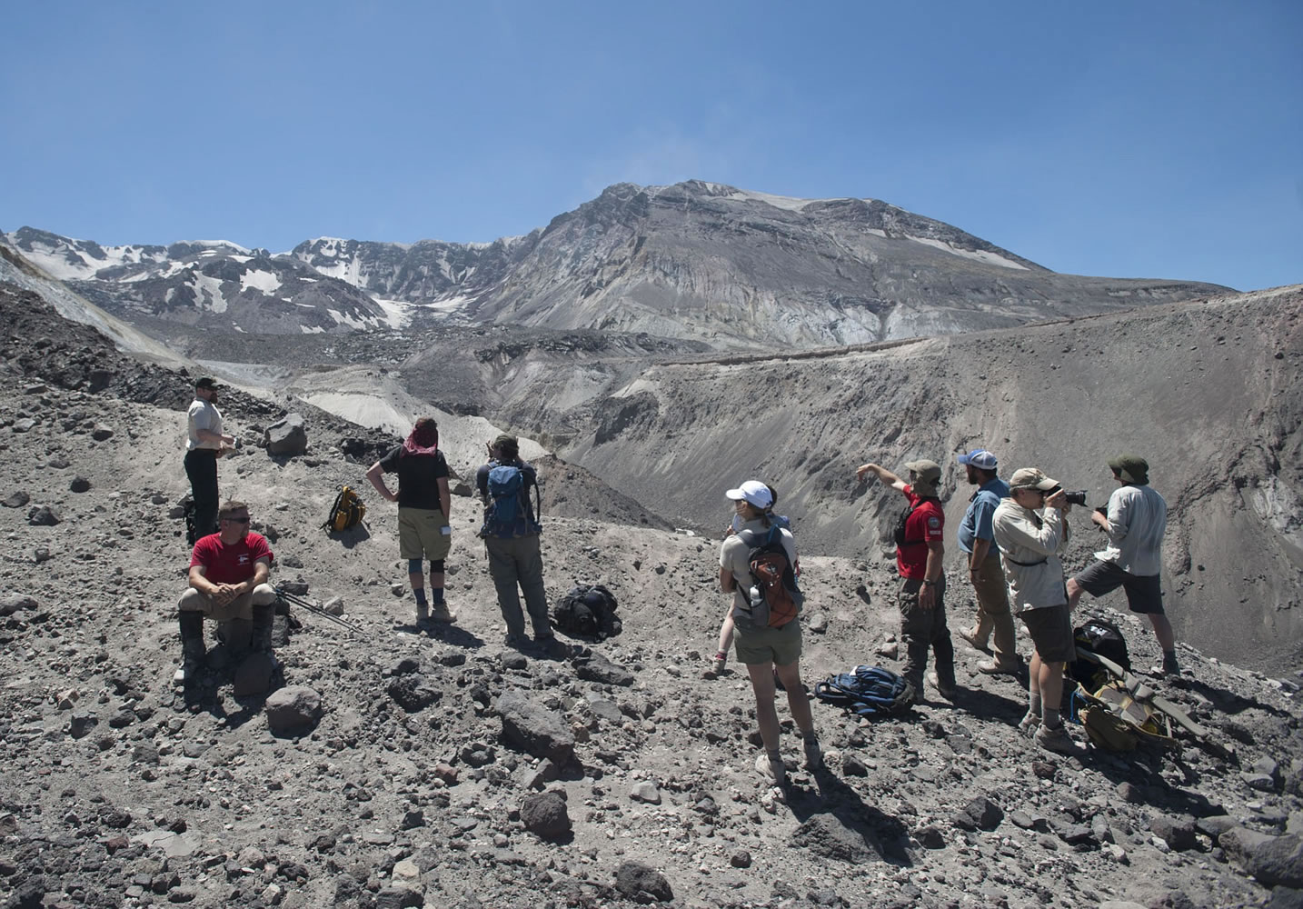
While the Crater Glacier View Climb ventures right up to the crater’s edge, people aren’t allowed into the caldera itself. And for good reason, Frenzen said.
“The crater is an incredibly dangerous place,” Frenzen said.
From the outside looking in, the area appears rugged but relatively peaceful. The steady sound of Loowit Creek flowing through the crater’s mouth stands out.
Inside the crater, it’s a different story.
Paul Pepper of Yacolt-based North Country EMS is among the agency’s Volcano Rescue Team members who have hiked and even camped inside the crater. Pepper described hearing water rushing under the glacier as he stood on it. Steam vents release pressure. Rocks occasionally fall nearby.
“It is live in there,” Pepper said. “Everything moves.”
The terrain presents a lot of challenges for even the most experienced outdoor enthusiast, which is why it would be incredibly difficult to rescue someone who became injured or stuck, Pepper said.
That’s largely why the Crater Glacier View Climb exists only as a guided trip, Frenzen said. The Mount St. Helens Institute is allowed to offer the hike under a permit from the U.S. Forest Service, which manages the Mount St. Helens National Volcanic Monument. And North Country EMS will likely accompany many of this year’s trips, Yurkewycz said.
Lawetlat’la
Mount St. Helens rests in a state of relative slumber for now. But it remains an active volcano less than a decade removed from its last eruptive phase that ended in 2008.
For many, the mountain is still defined by the May 1980 blast that flattened miles of forest, darkened skies and killed 57 people. Mount St. Helens is now among the most closely monitored volcanoes in the world, Frenzen said. And scientists know it will erupt again, he added.
The volcano’s explosive history started long before 1980. Native people have long recognized that history as part of the mountain’s identity, said Nathan Reynolds, an ecologist with the Cowlitz Indian Tribe. The Cowlitz name for Mount St. Helens, Lawetlat’la (“The Smoker”), evokes its fiery past, Reynolds said.
Mount St. Helens’ cultural significance to the Cowlitz Tribe and the Yakama Nation helped it earn special recognition in 2013. The mountain was designated a Traditional Cultural Property and listed on the National Register of Historic Places. It’s one of just 23 Traditional Cultural Properties in the country, and one of two in Washington.
“As you climb the mountain, you enter a place that’s of stronger spiritual power for the indigenous people,” Reynolds said.
The same can be true for any visitor, Frenzen said.
“There’s a whole world out here that people can connect with and spend time with and form their own relationships with,” he said.