On a huge snag, in the middle of Coldwater Lake, perched an osprey.
Surrounded by one of the newest lakes on the planet, and with Minnie Peak towering overhead to the northeast, the bird had a fine view.
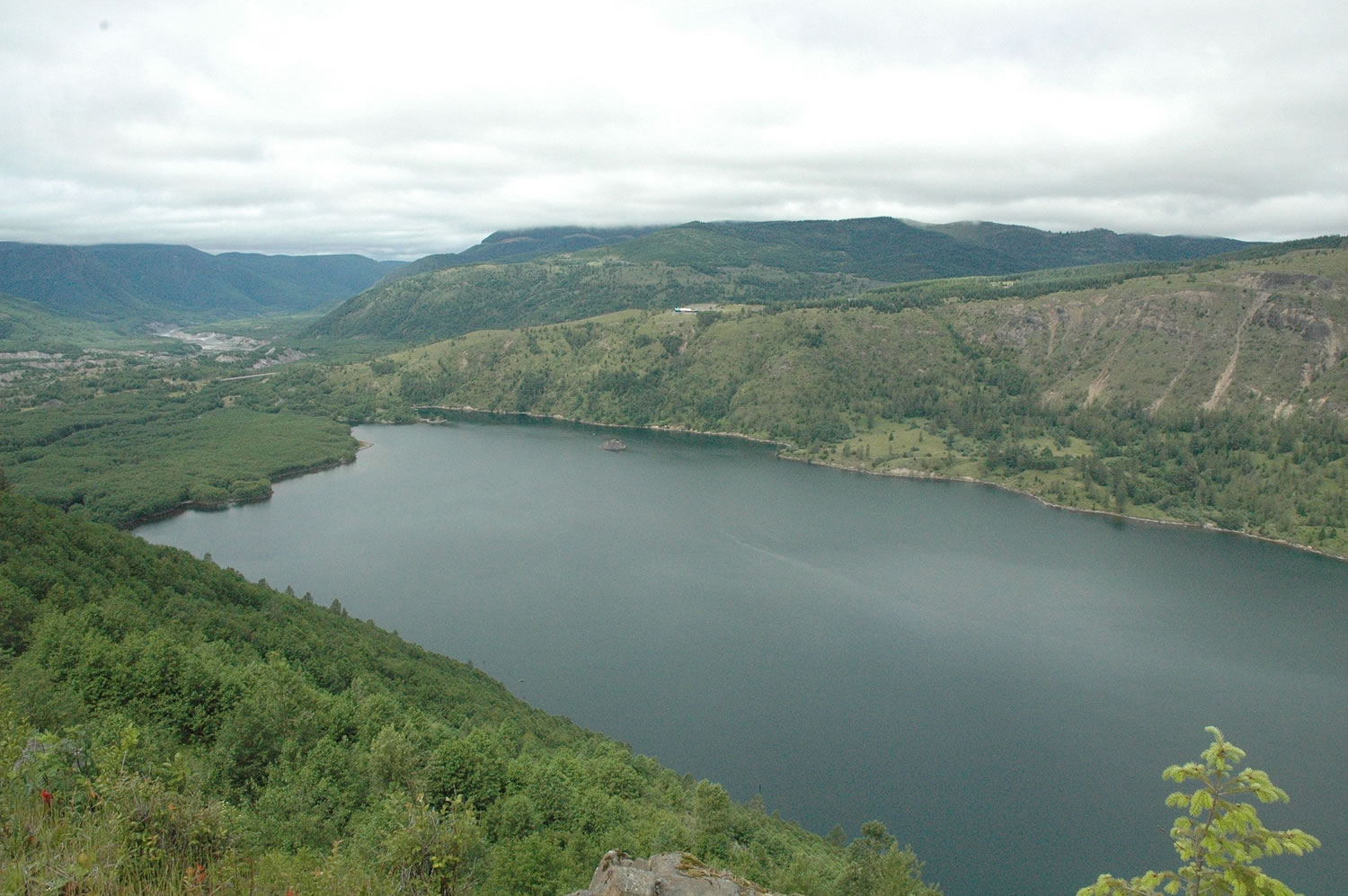
Hikers and bikers who combine South Coldwater, Coldwater and Lakes trails for a 10.1-mile loop around Coldwater Lake will be rewarded with fine views, too.
Take Interstate 5 north to exit 49. Take state Highway 504 east to the South Coldwater trail No. 230A parking lot at milepost 47.
It may not be the jaw-dropping, ridge-top splendor of the Goat Rocks or Mount Adams, but Coldwater loop in the Mount St. Helens National Volcanic Monument belongs on a local hiker’s life-list of trails.
Here’s one warning though: There’s 1.7 miles of walking on state Highway 504 between the two trailheads.
The “loop” is best hiked counterclockwise beginning at the trailhead for South Coldwater trail No. 230A.
The trail climbs on both sides of the ridge, but mostly offers views of Coldwater Lake.
At 1.57 miles, the trail passes demolished logging equipment once belonging to Weyerhaeuser Co.
The massive May 18, 1980 eruption was on a Sunday so no one was at the site.
The land belonged to Weyerhaeuser prior to the eruption, then was acquired by the Forest Service and made part of the volcanic monument.
The high point in elevation (3,922 feet) comes at 2.86 miles from the trailhead, then the route drops slightly to the junction with Coldwater trail No. 230 at 3.44 miles.
The junction is a nice rest stop. Intermittent clumps of lupine, paintbrush and penstemon add spots of color.
At the junction, follow the sign and go down trail No. 230 toward Lakes trail No. 211.
The trail drops almost 1,200 feet in elevation in 1.9 miles. This stretch is a bit brushy as it passes through the alder.
At 5.31 miles from the trailhead, the path crosses the substantial bridge spanning Coldwater Creek.
Trails No. 230 and 211 used to join farther up Coldwater Creek. Then in the mid-1990s, a landslide up the canyon let loose and wiped out the original bridge, so it was rebuilt closer to the lake.
Coldwater and Lakes trails join just beyond the bridge.
The final leg of the hike is 4.75 miles down Coldwater Lake to the trailhead at the boat ramp.
There is a designated water access point 0.7 mile down the lake from the junction of Coldwater and Lakes trails and a second one slightly more than a mile upstream of the boat ramp.
Andy Jansky of Portland said the Friends of Coldwater, a collective of mountain bike groups, adopted Lakes trail No. 211 in 2012 and do extensive trail maintenance annually.
The collective goes in with weed-sackers, chainsaws and other tools to fix eroded spots and realign the trail where safety is a concern.
“It’s got to be rebuilt in places every year,” he said.
He rated its riding level at intermediate or slightly easier.
Lakes trail is second only to Ape Canyon trail on the south side of Mount St. Helens among mountain biker favorites, Jansky said.
“Lakes trail is beautiful, it’s on the water, it’s got amazing views,” he said. “When we started, it was barely rideable and difficult even to walk. The trail would disappear if someone didn’t go in and tend it.”
“Their commitment to these trails is one important aspect of the Forest Service being able to open these trails up to bikes,” said Lisa Romano, community engagement specialist for the Mount St. Helens National Volcanic Monument.