CHELATCHIE — Rob Glassman of Tacoma wanted a hiking and camping location away from crowds and traffic.
“So I looked at the map and picked a point deep enough in the woods that it can’t receive too many people,” said Glassman.
That point turned out to be Siouxon trail No. 130 in the southwest portion of the Gifford Pinchot National Forest.
Hiking partner Joey Howell of Salt Lake City said he was “100 percent impressed.”
“It’s a pretty cool spot,” Howell said. “The green –there’s so much moss here — it’s really different from Utah.”
Follow state Highway 503 to Chelatchie. At the general store, turn right on Healy Road and follow the main route 2.2 miles to a four-way intersection. Continue straight for 6.8 miles to the Gifford Pinchot National Forest boundary. Take road No. 57, the first left, uphill for 1.2 miles then turn left on road No. 5701. Follow No. 5701 for 3.7 miles to a trailhead sign and parking at the end of the road.
If it was green that Howell was looking for, he had come to the right spot.
Siouxon Creek in spring is like peering into a kaleidoscope containing a hundred hues of green.
The stream itself is a series of emerald pools amid rapids and small waterfalls. There’s moss of different shades everywhere, not to mention the heavy mix of deciduous and conifer trees.
With each step, the collage of firs and ferns, shamrock and salad, moss and vine maple changes as the sunlight filters through the forest at slightly different angles.
Siouxon trail No. 130 is actually 10.4 miles in length. The lower three miles from the lower trailhead on Gifford Pinchot National Forest road No. 5701 is an uneventful walk through second-growth forest with only a couple of small creek crossings to break the boredom.
It is the middle section of the trail — from the trailhead at the end of road No. 5701 to Chinook Creek — that gets the lion’s share of use.
From the parking area, trail No. 130 drops, then crosses over a bridge spanning West Creek and passes the west junction with Horseshoe Ridge trail No. 140 at 1.25 miles.
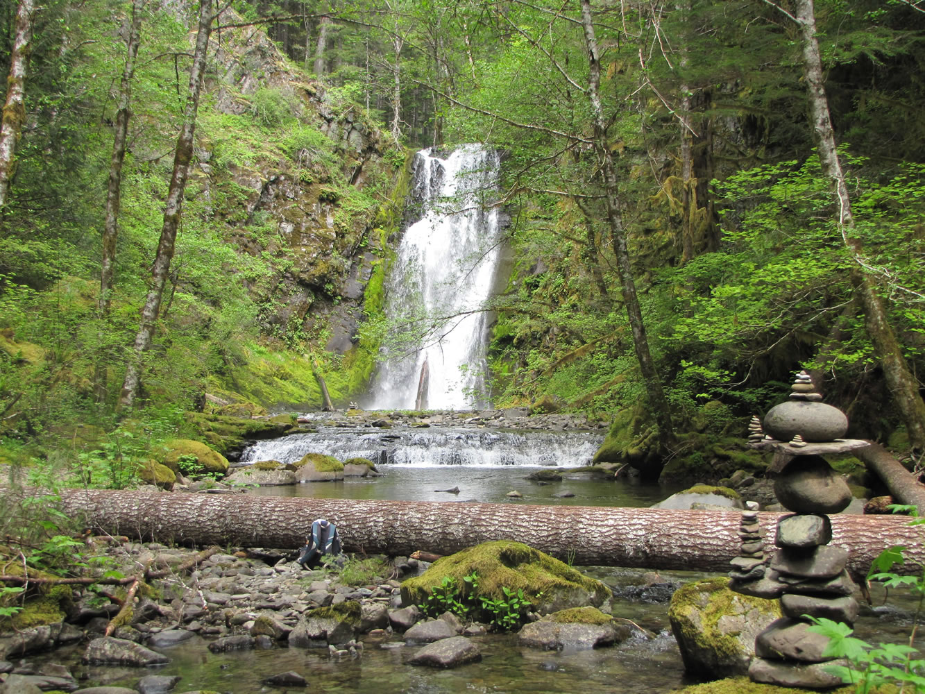
Siouxon trail No. 130 crosses Horseshoe Creek at 1.9 miles. There’s a great camping site and view of the Horseshoe Creek Falls a bit east of the bridge crossing the creek.
Siouxon Falls is passed at 2.37 miles and the junction with Chinook Creek trail No. 130A is reached at 4.69 miles and only 160 feet of elevation gain from the trailhead.
Siouxon trail continues east another 3.5 miles to its end on road No. 58, but this is a stretch of the trail little used.
Most hikers cross the bridge spanning Siouxon Creek and follow Chinook Creek trail No. 130A for a half mile to Chinook Creek Falls.
For the adventurous, there’s a large log spanning Chinook Creek, which allows hikers to cross and and backtrack west on an old trail on the north side of Siouxon Creek to Wildcat trail No. 156.
The bridge across Siouxon Creek on Chinook Creek trail No. 130A is closed due to safety concerns, and marked off with pink ribbon. However the structure was getting used on Memorial Day weekend.
Robin Rose, recreation program manager for the Gifford Pinchot National Forest, said trail crews are waiting to get design approval from the Forest Service regional office for repair of the bridge.
The Pinchot has staff with the skills and materials to build a new bridge and enough money once design approval is given.
“We don’t want any hikers or horses to get injured trying to use the bridge, so we are asking people to observe our closure and to not use it until we can do repairs or replace it,” she said. “We were hoping to not have to dismantle it before we sent the crew back out to repair or replace it.”
Rose said she does not know how long the engineering review and approval process will take.
“I don’t think it takes a lot of work once it gets to the top of the pile,” she said. “It just has to get in the queue with other regional bridge projects.”
Rose suggested hikers try other trails until the bridge is repaired or replaced.
Siouxon Creek’s flow is most impressive in early spring, yet in the heat of summer the trail offers a cool hike under a deep canopy of trees.
“It’s subtle beauty below the forest canopy and a wide variety of water features from pools and riffles to spectacular waterfalls make it (Siouxon Creek) one of the most scenic rives in the state of Washington,” according to the Forest Service’s 1990 land-use plan for the Gifford Pinchot National Forest.
Howell’s brother, Andy, of Eugene, was asked if he agreed with the Forest Service’s description.
“It’s all what you make of it,” he said. “You can’t rate nature. I will come back.”